 Review of “Railroads and the Making of Modern America” by Pohlert /Ali
Spatial humanities is a field of study that uses technological tools and mapping to analyze human culture, especially focusing on minorities and their outlook on history.
- The site is spatialized very well. There are different categories and sections to help navigate the website. There is also a search engine specifically built for the website, which allows people to narrow down their results. It fits loosely into our original definition, but can be changed to include mapping as an important part of spatial humanities.
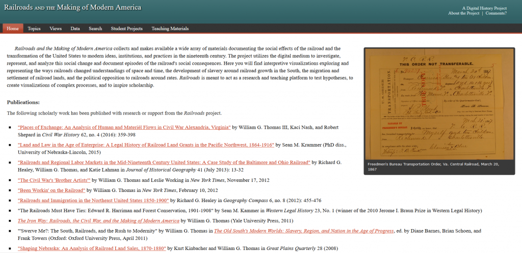
- We see an explicit spatial argument of the interface not being intuitive. The homepage could be organized differently, in a way that makes a more interactive interface. The format of the homepage could be reorganized. The sections/tabs could be turned into side tabs that show previews of the information. An implicit spatial argument in regards to the visual interactive components being difficult to find when they are very useful tools within spatial humanities.
- The purpose of the website is to show the history of American railroads, acting as a “research and teaching platform for scholars to test hypotheses and create visualizations of complex processes”. It’s a digital project online from University of Nebraska – Lincoln made graduate students with open-access to help researchers use railroad data.
- It’s intended mainly for students conducting research on railroads and other scholars who focus on histories related to the railroad system. It’s also intended for teachers for its tab ‘teaching materials’. Another audience would be families who have ancestors who helped build or lived/died through enslavement and the railroads being built.
- The user interface is simple and straightforward, but can be improved visually. It’s slightly cluttered with links. The ‘views’ tab could be renamed to ‘visual aids’ or ‘visual photos’ to establish a better way to move around the website.
- The data section could be improved with embedded visuals of the data. The website could also be modernized. It would be more helpful to have the hyperlinks embedded under helpful words, rather than labeled out in a boring, cluttered manner.
- We see the website as being quite effective at conveying historical and spatial knowledge, but it could improve its use of digital technologies. The search engine and interactive maps are good uses of digital technology. The visual maps are hidden, so we argue that the website could make these great uses of digital technology more easily visible and accessible.
