http://niche-canada.org/yearwithoutasummer/
The use of maps, locations, and/or quantitative methods in posing, visualizing, and investigating new research questions pertaining to myriad humanistic disciplines.
- Impacts of cataclysmic and climatic events are mentioned in geospatial terms. The project is therefore spatialized in its mission, but its application could be improved. The project fits within our definition, because it uses locational differences to analyze the understudied topic of global weather patterns and how various people reacted differently based on region. The definition cites the use of maps first, but overall location analysis remains the crux of Spatial Humanities.
- Spatial parameters are explicit in that the site specifically discusses a global and regional weather variations and reactions. The organization of newspapers and other documents implicitly relate the regional differences of Canadians. The project organizers also make important claims regarding differences between urban and rural communities in response to the climate shifts.
- The project’s objective is to inform readers about impacts of climate in myriad related topics (food, farming, charity are mentioned on the home page). Overall, the goal is to boost general knowledge of climate history.
- The intended audience includes “teachers, history nerds, weather geeks, Canadians, online trolls, everybody…” and specifically addresses goals and objectives for each group. It lays out specific questions to ask, encouraging a climate of research and classroom-oriented interpretation for both younger and older students. The surplus of colloquial language implies an audience of middle or high school students, though, and could dissuade scholars at the collegiate level and above.
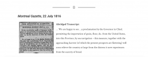
- The user interface is helpful and spatially-oriented, but dominated by links rather than visualized spaces. Sources are listed clearly based on geography and in alphabetical order. There is a helpful “Whys and Hows of Using this Site” page that gives people who may be less familiar with digital projects the ability to accurately utilize it. Critically, though, there is no direct mobile site. When typing the URL into a mobile device, it brings you to the larger department website for “Niche-Canada” and not the actual project itself. Each primary source is also transcribed which helps those who cannot read the source’s small print or handwriting.
- The project is lacking in maps. Those unfamiliar with Canadian geography can be thrown off or incapable of garnering a distinct picture of what the author intends to illustrate. Maps and other visual aids often help readers connect events in a way that words cannot, and they would be an invaluable addition to this particular project. Maps of global air currents, average temperatures, and historical agricultural output would be particularly useful. There may be additional language barriers, assuming a great deal of users are French-Canadian, and there doesn’t appear to be a method to toggle between languages.
- This project is useful in conveying historical and spatial knowledge, but there is clear room for improvement. The collection of periodicals, diaries, newspapers and government resources allow more users to engage with material and provide materials that a library cannot. The mission statement on the homepage makes it more effective than a few other collections as well. One ineffective presentation element is the use of grossly informal language (i.e. internet trolls be nice). It renders the work far less credible than it could be. While the spatial argument itself is credible, some of its presentation detracts from the overall experience.
Rubric:
4 – Project demonstrates mastery of spatial methods and clearly utilizes plentiful maps, models, and other visual and/or quantitative aids to advance existing historical questions and raise new ones. Interface is accessible and easy to use, even for those with little technological background. There is a clear and concise goal for the project rather than simply a collection of documents.
3 – Project demonstrates above average use of spatial methods and has some maps, models, or other visual aids to assess historical questions, potentially not raising new ones. Project might use location based pages or texts clearly, but does not use maps for assistance or as a tool. Clear interface that may or may not be easy to use but has some type of “How to” page. There is a goal stated, although not explicit.
2 – Project demonstrates some use of spatial methods, but has few to no maps, models, or other visual aids and does not accurately assess scholarly questions. More documents than analysis or engagement. There may be some inconsistencies with interface. There is a goal stated, but it could use improvement. Project authors do not fully elucidate spatial purpose.
1 – Project demonstrates no spatial methods, and it has no maps, models, or other visual means. Simply a collection of documents. Difficult to use interface. No goal, purpose, or mission statement. Spatial aspects ignored or disregarded.
