Definition of Spatial Humanities: It’s the use of digital analysis tools for the academic community to explore and interact with the relationship between place and humanity.
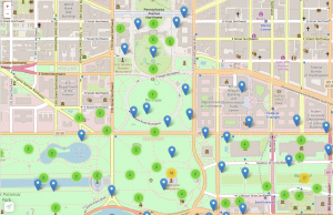
- The History of the National Mall project uses tools acceptable to our definition of spatial humanities. The use of maps, the inclusion of source citations, short descriptions of event/subject, and good categorization to connect events/subjects, provides an interactive space for visitors to have a variety of experiences.
- The site makes a fairly compelling and explicit spatial argument in relation to the significance of the National Mall as an historical space. The design of the map and the placement of the individual entries within it through the use of geotagging connects the documents and events to a real space. The details in entries like “The Klan Walks in Washington” give physical dimensions to aspects like crowd size, while giving context to the reactions of observers, making the space feel real. Furthermore, the Exploration section provides more expansive coverage of the development of the space of the Mall with further examination of the changing physical designs of the monuments it contains.
- The objective is to provide a user-friendly map that allows participants to easily research the National Mall ahead of time or during a visit. The quantity of information and subjects is not overwhelming, although it would be more than a day trip to visit each reference point.
- The intended audience of the site seems to be more on the general side, non-academics with an interest in American history and the history of the Mall itself. The drag and click style of the map seems well suited for tourists to use while visiting. The site provides a good overview and some specific details that would work to satisfy the curiosity of amateur historians. Professional historians could make use of the sources as up to date citation information is provided, but it does not seem to be meant to function as a primary research archive.
- The interface is very inviting with clear links and headings that help direct you around the site. The look is quite attractive and the map, a central feature, works well and is easy to navigate. There is a difference in how the interface functions based on what device is being used to access the website. It seems more tailored for touch orientated devices like phones and tablets, as navigation is somewhat clunkier on a standard desktop computer. The site feels geared towards being used in the actual space of the Mall.
- Nothing obviously needs to be removed, but in terms of additions, the site could benefit from providing a different experience for those on a traditional computer. The Exploration section does a fair job of this, with longer, more expansive entries on particular questions, but the effect of the map seems to be a little lost if one cannot follow it while visiting the Mall. A 3D rendering of the map could prove beneficial for those who cannot make the trip.
- The Histories of the National Mall project is quite useful for a visitor hoping to get a more than a few photographs at the mall. The website conveys the history of the mall through a user-friendly map, which shows the significance of each location. Because the site does not have a “Best of” section, it forces the user to interact with each location on their own rather than taking a guided tour. This enables the user to make discoveries in the place they are present, which helps the spatial argument of this project.

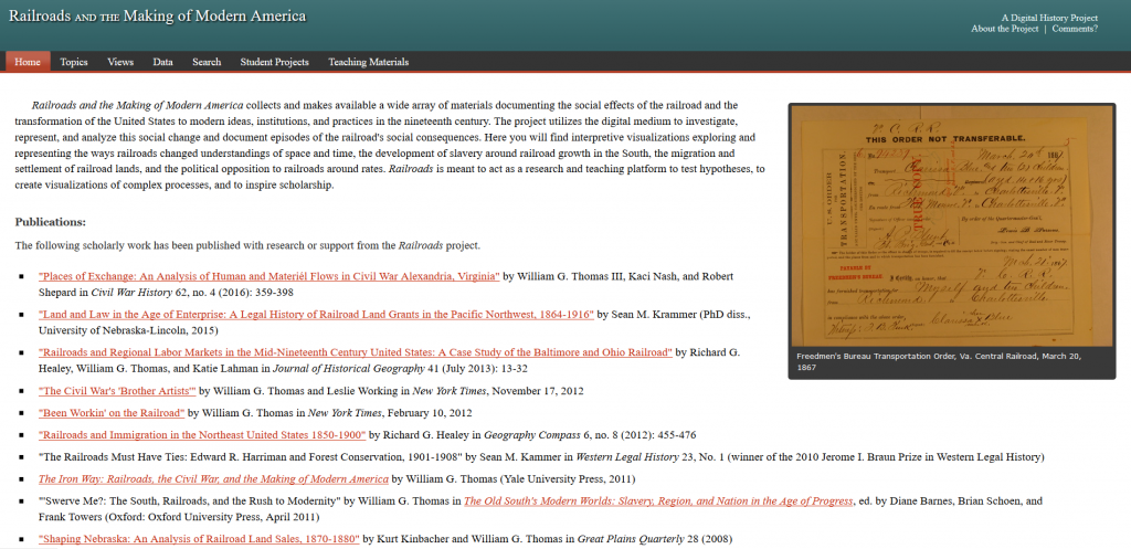 Review of “Railroads and the Making of Modern America” by Pohlert /Ali